Indoor Navigation
Indoor Navigation Using Vuforia Area Targets
Overview
Role:
Design and Development
Year:
2021
Objective:
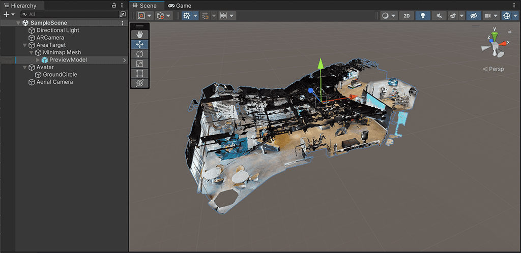
To develop an indoor navigation system that uses pre-captured 3D scans from iPhone’s LiDAR and Vuforia’s Area Targets. The system was designed to provide accurate, stable navigation with real-time pathfinding using the A* algorithm for precise route guidance.
Technology:
iPhone LiDAR
Vuforia Area Targets
Unity
Blender
Role:
Design and Development
The Challenge
Traditional indoor navigation systems often struggle with accuracy, especially in complex environments where continuous scanning can lead to performance issues. The challenge was to build a system that only required a single 3D scan, processed into Vuforia Area Targets, and used the A* pathfinding algorithm to calculate precise routes in real-time without needing ongoing scans.
Innovation and Vision
This project was focused on enhancing indoor navigation by using pre-captured 3D scans and Vuforia Area Targets for spatial anchoring, while implementing A* for real-time pathfinding. The idea was to ensure that once the environment was mapped, users could navigate it with accurate, stable, and dynamic routing.
Key Challenges
Ensuring that the initial 3D scan provided sufficient data to create stable Vuforia Area Targets for AR markers.
Integrating the A* pathfinding algorithm to calculate efficient routes in real-time while navigating the indoor environment.
Developing a seamless UI that combined pathfinding with AR overlays to guide users clearly and intuitively.
Solutions
Utilized iPhone LiDAR for the initial 3D scan, then processed it into Vuforia Area Targets to anchor navigation paths within the real world.
Integrated A* pathfinding into the system to calculate optimal routes based on the user’s current position and destination, ensuring efficient and accurate navigation.
Designed the interface with a focus on simplicity and usability, allowing users to intuitively follow the AR guidance without needing to understand the complexities of the algorithm.
System Design
Pre-Captured 3D Scanning and Vuforia Area Targets
The indoor environment was captured once using iPhone’s LiDAR to generate a detailed 3D model, which was then converted into Vuforia Area Targets. These Area Targets anchored the AR navigation system to the physical world, ensuring stable positioning for AR markers without needing continuous rescanning.

AR Navigation Framework
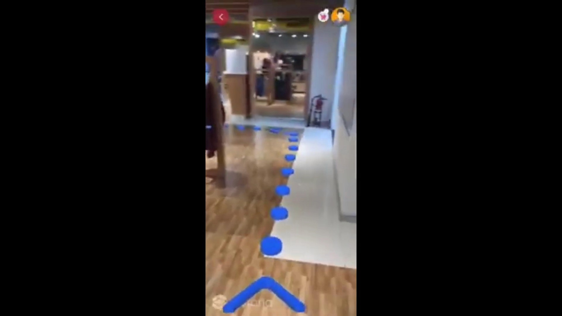
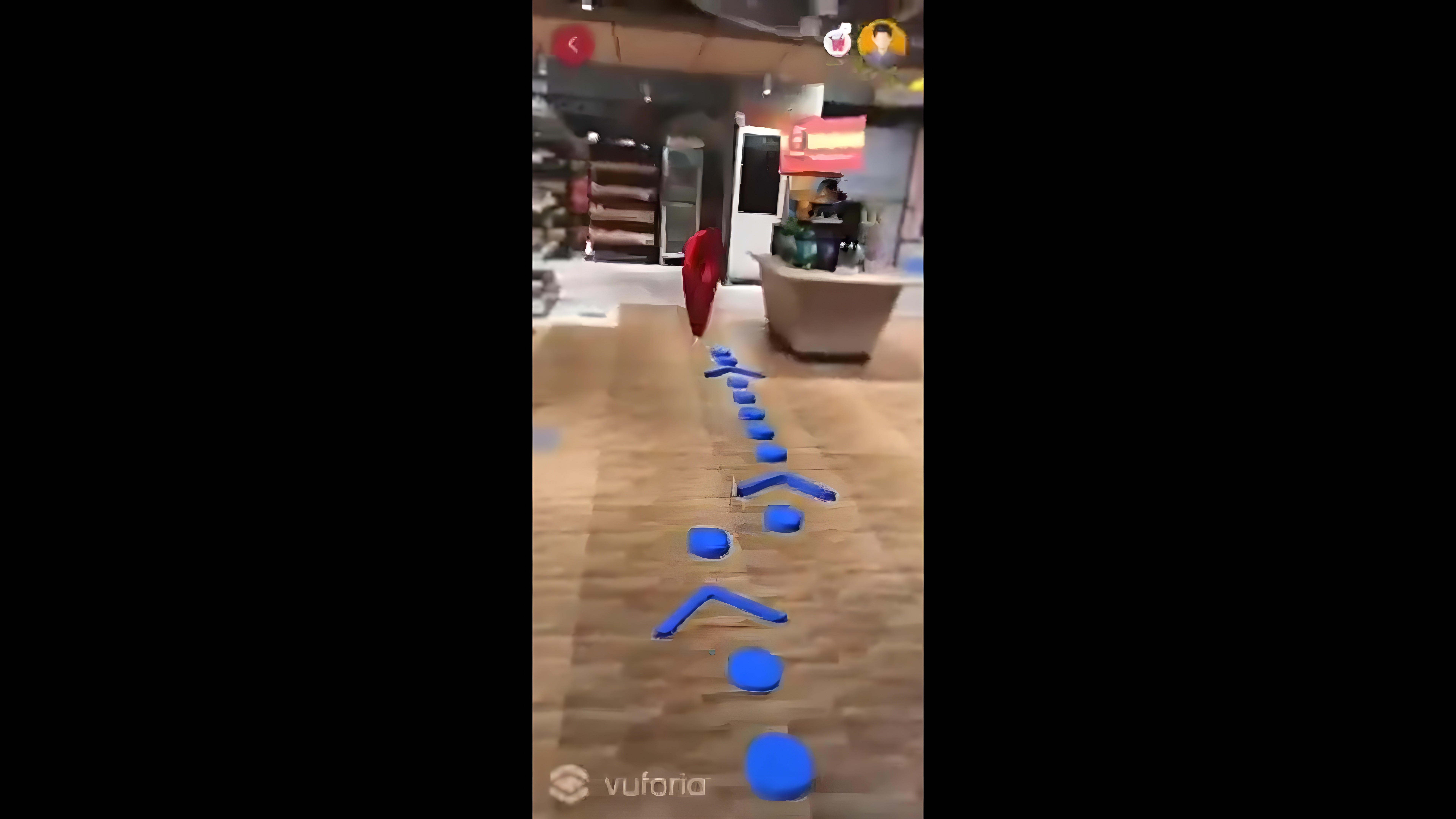
The AR navigation system used Vuforia’s Area Targets to display directional cues within the indoor environment. The A* pathfinding algorithm calculated the best route, while the AR markers guided users through the space with stable, reliable paths.

User Interface and Experience
The UI design prioritized simplicity and user accessibility, ensuring that users could easily follow the AR paths generated by A* without any confusion. Real-time feedback and clear directional cues were integrated into the AR experience.
Key Responsibilities
Design
I led the design of the user interface and interaction model, ensuring that users could easily follow the calculated paths. The design emphasized clarity and simplicity, allowing users to intuitively navigate through complex indoor environments.

Development
I developed the system’s integration of Vuforia Area Targets with A* pathfinding and the AR framework. This involved ensuring that the pathfinding algorithm worked seamlessly within the real-world environment, providing accurate, real-time navigation guidance.

Project Highlights
Pre-Captured 3D Scanning and Anchoring
The system successfully leveraged iPhone LiDAR to generate accurate 3D scans that were converted into Vuforia Area Targets, allowing stable anchoring of AR navigation paths.
Real-Time Pathfinding with A*
The integration of the A* pathfinding algorithm allowed for dynamic, real-time calculation of optimal routes based on the user’s position. This ensured users always received the most efficient and accurate guidance.
Seamless AR Navigation
Users experienced smooth, stable navigation thanks to the accurate AR overlays anchored by Vuforia’s Area Targets. The A* algorithm provided real-time recalculations to keep navigation precise.

Outcome and Impact
The indoor navigation system successfully demonstrated how Vuforia Area Targets and A* pathfinding could work together to provide accurate, stable, and efficient navigation in indoor environments. By relying on pre-captured scans, the system reduced the need for continuous rescanning, making it more practical and user-friendly.
Learnings
This project taught me the value of combining pathfinding algorithms like A* with AR technology to enhance indoor navigation. The experience emphasized the importance of high-quality initial 3D scans and optimizing the AR experience for user-friendliness.
Future Enhancements
Future developments could include:
Expanding the system for multi-floor navigation, allowing users to navigate through more complex indoor environments.
Integrating voice guidance alongside the AR path markers for a more hands-free experience.
Enhancing scan accuracy to support larger indoor areas.


